Embedded Files
Trail: (PG & E Trail to Black Mountain and then to Skyline loop)
No of days: 1 day
Distance: 21 miles
Date: 06 April 2013

Picasa Web Album here
This was a surprise hike to all of us. We (Tissa, Meghana, Harsh and I) were to go to Big Sur to hike to the Sykes hot springs but in the morning after about 10 miles towards Big Sur, decided to go to Rancho instead. This decision was due to the lack of people and the fact that Big Sur is about an hour and half drive from San Jose. The decision was to hike to the trail end of PG & E trail then take then Black Mountain trail to the summit and then continue onto the Indian trail towards Skyline (on the way to Montebello road parking lot).

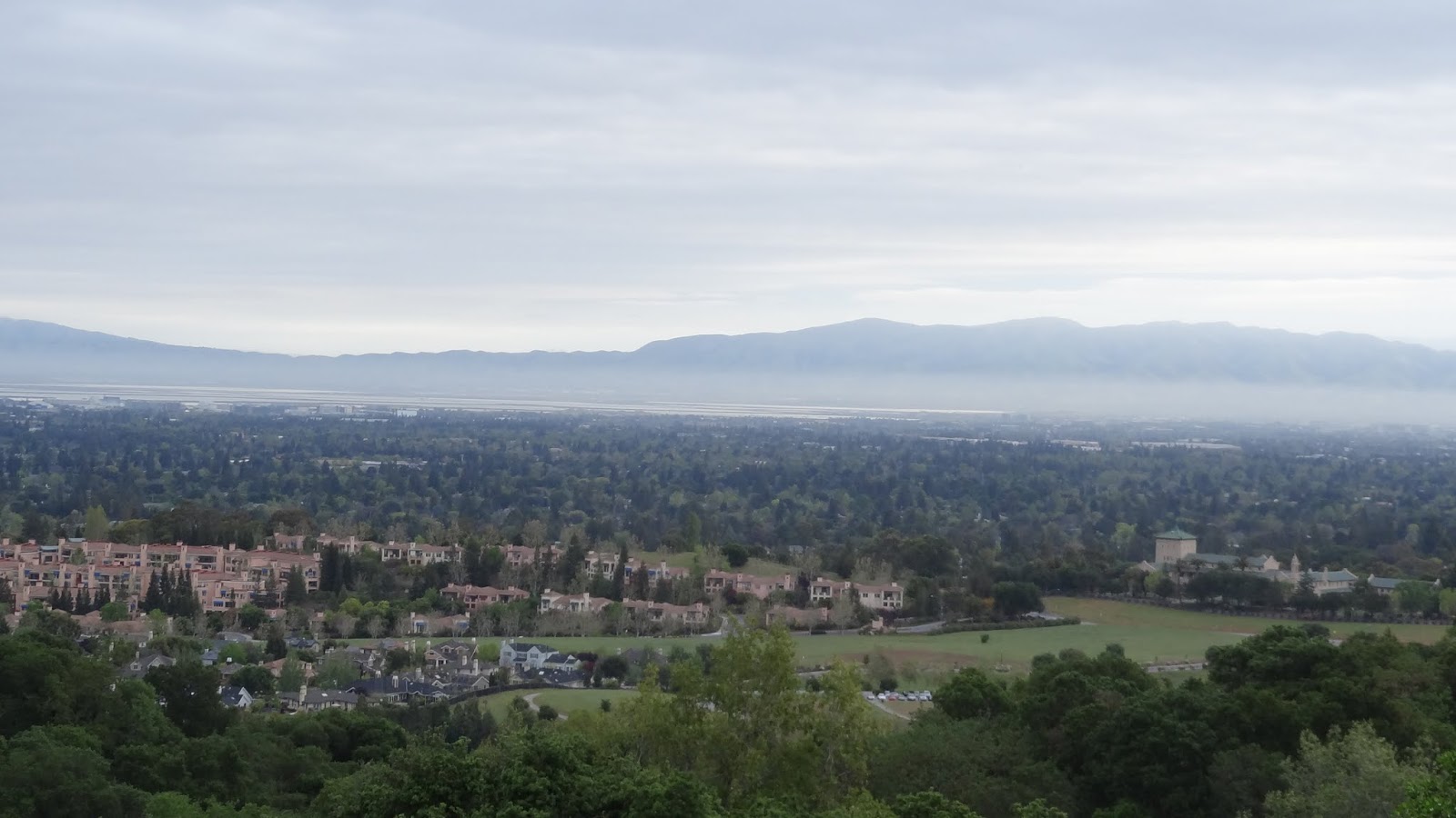
We reached Rancho San Antonio parking lot at 7:30am but to our dismay, found the parking lots full. Tissa parked his car in a residential area nearby. We started the hike at 8:02am. The weather was just perfect for the 20 odd mile hike that was planned for the day. It was cloudy but there was just enough sunshine to make it a very comfortable day to hike. The PG&E trail to the top was really fun. There were occasions where the trail opened up to beautiful views of the cities of Mountain View, Stanford and Sunnyvale in a distant space. The climb was pretty much quick and nice. I could see a large number of people on this trail – both walking and jogging. Most of them however were on their way back. This made me realize that yet again,

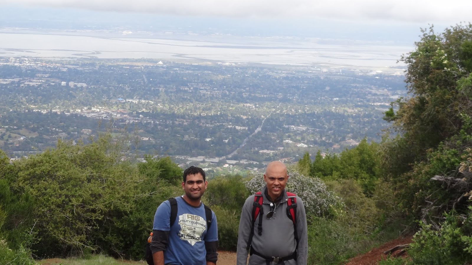
I was late to start the hike. I then realized why the PG&E trail was well known. It’s very close to the cities and it’s about 4.5miles one way. From the end of the PG&E trail (at the top), Stanford tower was visible. The bay majestically could be seen beyond all civilization. We continued towards Black mountain summit. This was about 2 miles from here. The trail was narrow and less visited by people. It felt like actually ascending the mountain. This stretch was extremely steep and took up a lot longer than I had expected. We reached the Peak of Black Mountain at about 10:30am. After a short break of 10 minutes, we started towards the Skyline ridge. We met a lot of bikers up there. That is something that I’m getting used to here in the US. A lot of mountain bikers ride their bike to the summit. Going down on a bike however would be an awesome feeling. I might try it sometime soon.
We took the Indian Trail towards Monte bello road parking lot. This also took us on the Rhus Ridge trail. Skyline was on this trail almost 0.6miles from the end. The side of mountain from the peak towards Monte Bello Parking lot along with the black mountain peak was engulfed by mist. It was as if we had ascended to a special place welcomed by silver curtains. The greenery along with the mist made it an awesome sight of all the things that nature has provided us. We reached a point which was about 1.2 miles to Skyline from where we decided to return. We took the Backpacker’s trail and joined the Black mountain camp trail to the summit. After resting at campsite 4 for about 15 minutes and having some great biscuits, carrots, a plum and some lemon cake, we continued to the peak and then down to the Rancho parking lot. We took a small backcountry trail on the way to the bottom that took us on the opposite side of the PG&E Trail. To be able to see the PG&E Trail from a distance itself was a very nice thing. We reached the car after passing through a diary farm at 3:00pm. It was indeed a wonderful hike and will go down in my memories as the first 20miler hike that I have done at one stretch that too in just 7 hrs. Picasa Web Album here Info: Place: Rancho San Antonio Open Preserve, San Antonio, CA
How to get there: From 101 take exit to San Antonio and follow GPS
Best time to visit: Just after winter and before summer. Spring would be a good time to hike here.
Other Activities: Nothing much other than hiking, horse riding, jogging and camping.
Permit: Not required. Required for camping.
More info: bayareahikes link here


Google Sites
Report abuse