Embedded Files
Trail: Mt. Whitney Trail
Trailhead: Mt. Whitney Portal
Camp location: Trail camp (12000’)
Duration: 2 days
Date: 10-11 August 2013
Distance: 21.4miles total


States (the lower 48 states of US). Thanks to Keerthi for being lucky enough to win a permit and allowing me to accompany him, I was able to go on this memorable and unforgettable 21.4-mile hike along with some great people. The group consisted of Keerthi – our lead, myself – yet another mountain lover, Shyam – ever energetic mind over body thinker, Sathya – excited about hiking, Sreenidhi – my new hiking friend and Srikanth and his friend Anisha – acquaintances from Cisco hikes. We had an overnight permit to Mt. Whitney on the 10-11th weekend of August 2013 and as planned had pre-briefings before the departure date of 9th August. After some discussions over email, we decided to camp at “Trail Camp” which is the upper camp closest to the summit at a staggering 12000’, 6 miles from the trail head. This would allow us to acclimatize better. Having rented 2 cars and being an hour late, we were on our way to Bishop, CA where we had a comfortable bed waiting for us for the night. The drive itself wasn’t very eventful to write about but we got to drive through Sonora pass, which had some beautiful winding roads that made sure the driver, was in their complete senses all the time.
<Day 1>
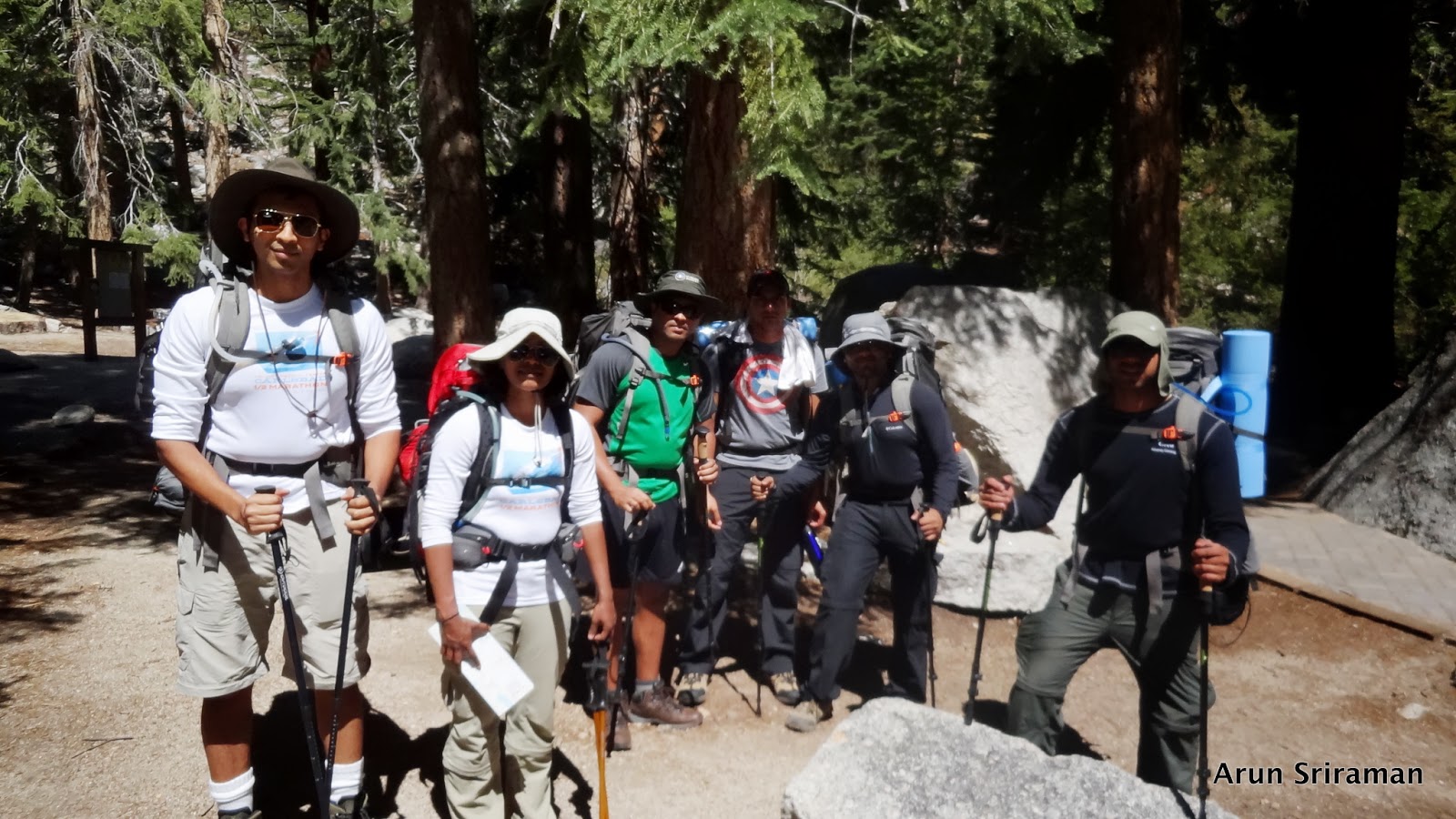
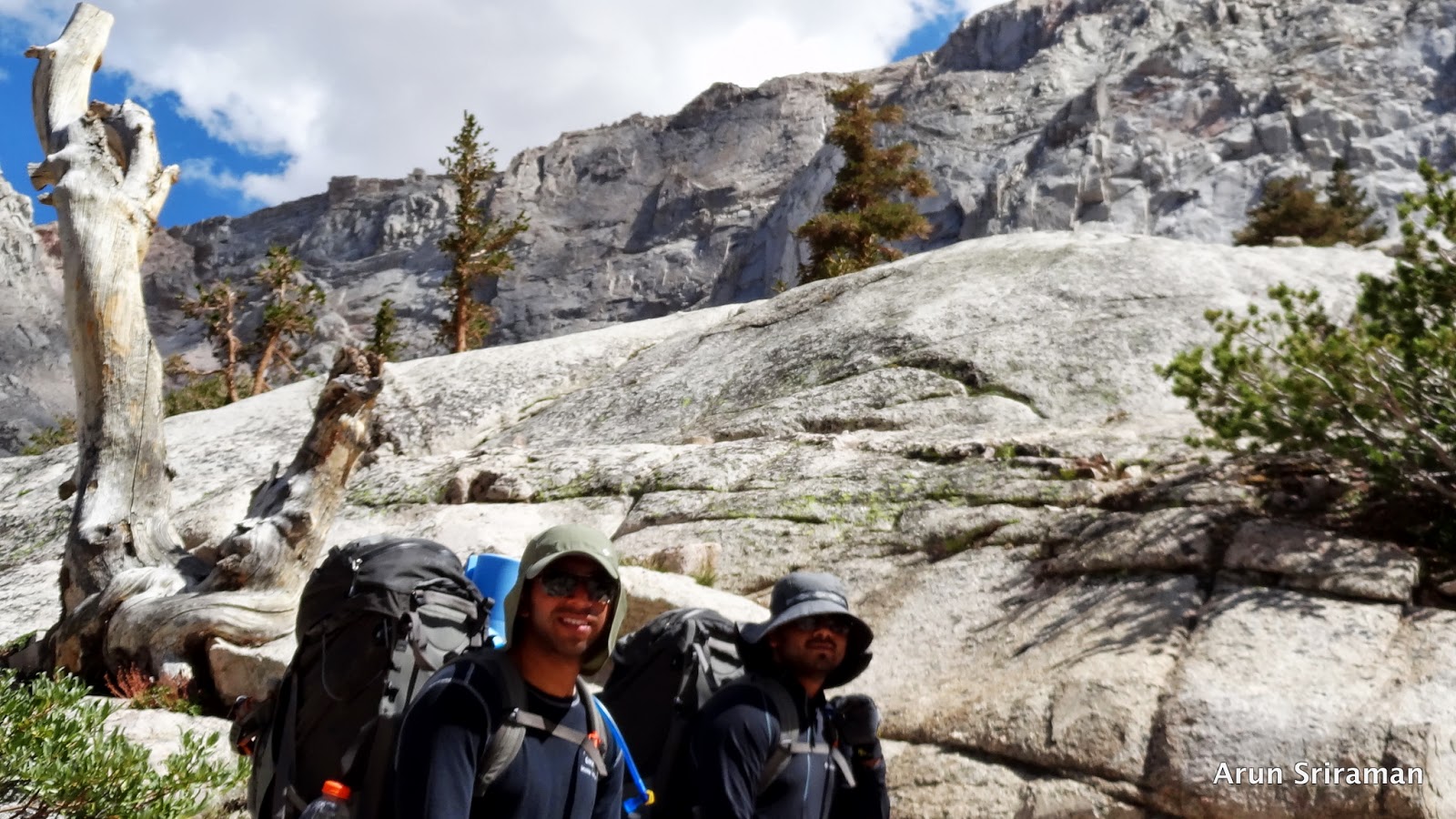
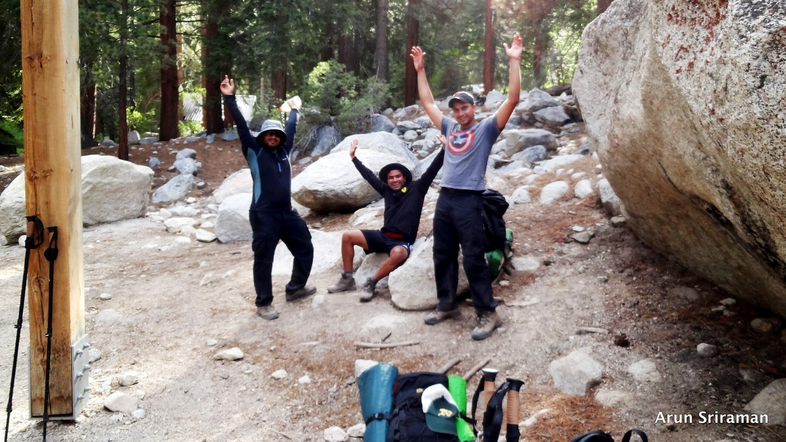
The arrival of daylight signaled the dawn of Saturday. We were up, ready and packed by 7:30am. All of us grabbed a quick breakfast, which was complementary at the Day’s Inn (Bishop, CA) and drove to the Interagency Visitor Center – about 2 miles from the beautiful town of Lone Pines off highway 395. The ranger handed over the permit along with the “wac” bags that are to be used for human waste disposal. We got two bear canisters to store our food supply from the visitor center and drove to Whitney Portal (Mt. Whitney Summit Trial). This particular stretch was an eye candy. The landscape looked like a masterpiece painting that one can find in an upscale art museum. We reached Whitney portal at 10:15am. It took us close to 45mins to pack our backpacks with the food and water. We weighed our backpacks at the trailhead that had a nice archway built along with a spring balance. My pack weighted a whopping 50pounds. We started what would be 6.5hrs hike to Trail camp at 11:07am from 8360’.
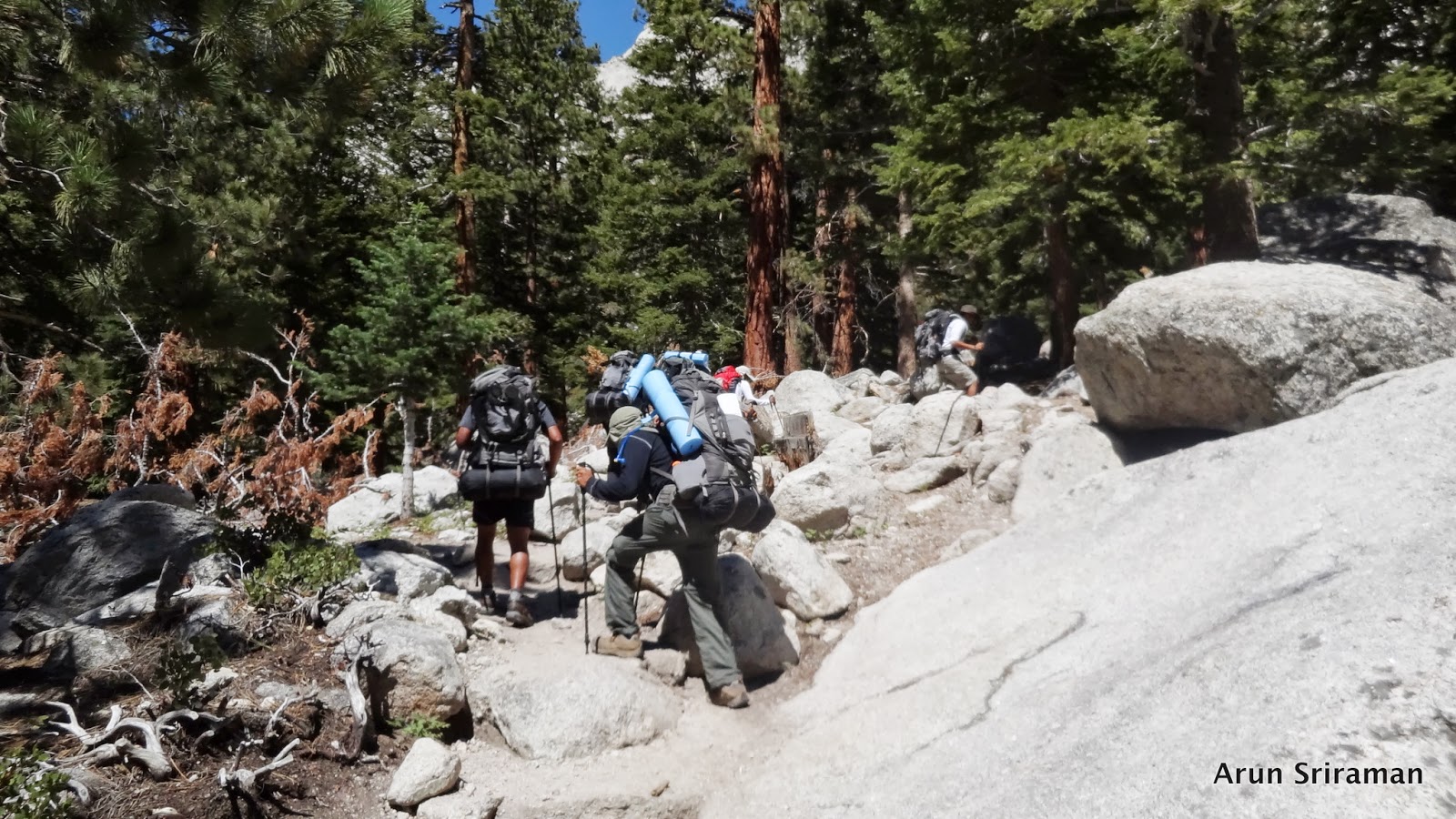
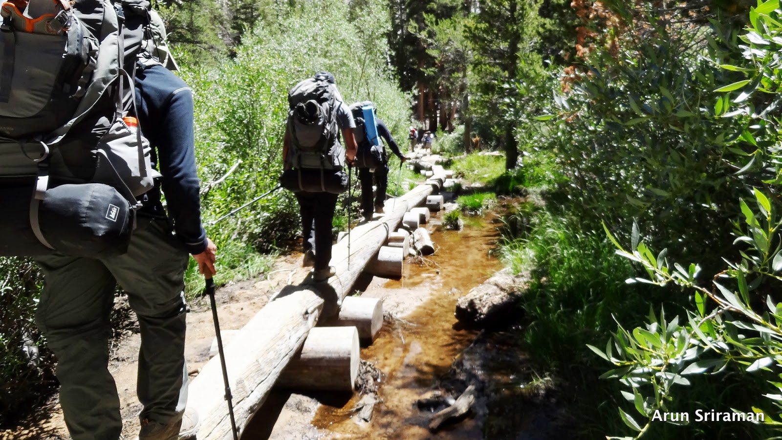
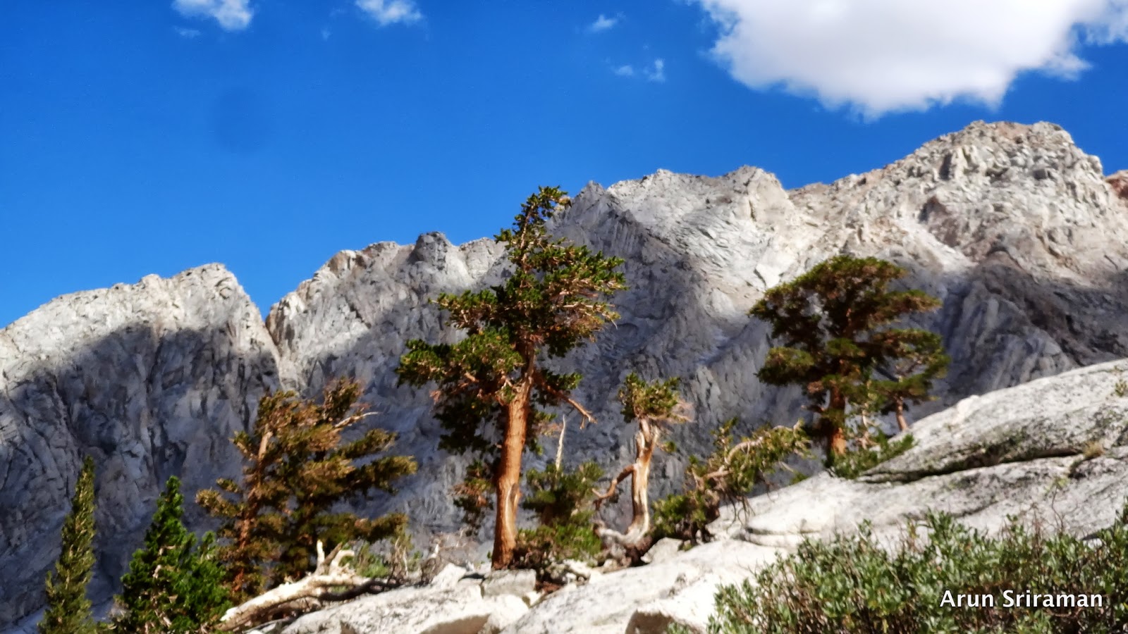
The initial mile or two was a gradual ascent with some beautiful vistas of the mountain ranges on both the sides. We were climbing higher into the valley towards what seemed to be an opening. The first signboard was that of “Inyo National Forest” board followed by a notice board that had two papers pinned to it. There wasn’t anything interesting. It just contained information about requiring permits and fire hazards in the forest area. There were also a couple of streams along the way, which we had to either hop across or hop over stones to get across. The trail was very well maintained indeed. People soon group up into two groups. The forward command or the spearhead as they call it consisted of Srikanth, Anisha and Shyam. Sathya, Sreenidhi, Keerthi and I made up the following unit. Keeping the rearguard was a duty that Keerthi and I performed in turns (End man/last man). The lead team made good head way. We all moved up at a very good pace.

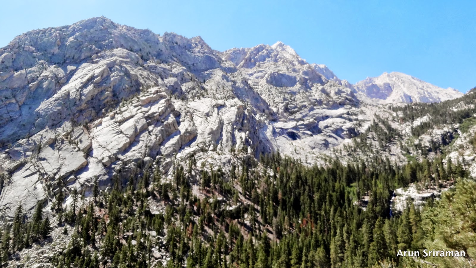
We reached the lone pine lake at 9900’ - 2.8miles from the trailhead at about 1:20pm. We did not stop for a break. Continuing ahead, we reached the Outpost Camp (10400’ – 3.8miles) at 2:30pm where we rested our feet and grabbed something to eat. I ate a packet of the ready to eat “bisi-bele-bath” – an Indian delicacy that is made of grams (Dal). This is the campsite that most people use for an overnight layover but we wanted to camp higher so that we would be able to figure out how much of a problem the altitude would be on each of us and partly also because I just wanted to camp higher and not have to walk the extra distance the next day to the summit as we had to drive back to the bay area after the hike. So at 2:45pm, we started the 2nd leg of the journey (2 miles) to Trail Camp. This 2mile journey was mostly above the timberline. It was hot and cold at the same time. The gradient was a lot higher than before and it was mostly rocks. Just as we started, a ranger stopped us to check our permits. He was holding a shovel and working on the trail to make it easier for people to-come. We had a brief chat during which he pointed out that it was okay for us to over stay a day if we liked and also that we had to use the “wac” bags for human waste and need to be dumped when we were back down. We bid adieu to him and continued on our journey up to trail camp. The route was something out of the world. We were literally ascending to the clouds. The vastness of the mountains around us was so mesmerizing that the fact of how small I was in the grand universe of everything dawned upon me. It was Nature’s decision whether we could make it up to the top and back after all. The weather was just perfect and it was a great day to be climbing up to trail camp. The wrath of nature is indeed something that every mountaineer needs to weigh very carefully before journeying amidst nature.
We finally saw a huge valley with a big glacier lake right in the middle. It was as if a mother was holding the lake with both hands tugged close to her heart. I can go back to that place in time clearly and I’m sure I will remember that scene going ahead during my entire lifetime.
I cherished the sight and chugged along towards what seemed to be a long-long way. The camp was nowhere in sights and I could imagine the mountains being alive and teasing me. Finally some tents came into view. Aah, it was about time we reached trail camp. We continued further to find the trail camp nestled between two lakes. Anisha and Srikanth had found us good camping spots already. It was close to 6:00pm and we started pitching the tents. At 6:45pm we decided to refill our water bladders and prepare dinner.
<Camp>

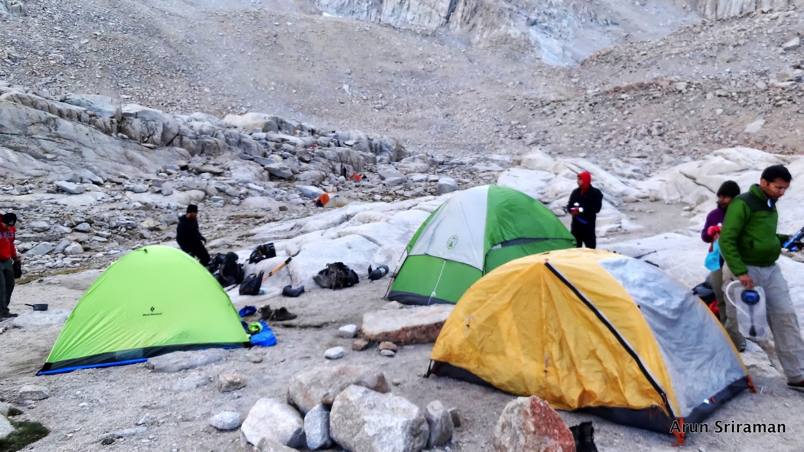
After the tents were up and I was idle for a while, I felt a little uneasy. It was the altitude I assumed. We refilled water, which was again a very funny and a memorable event. Shyam with his cold immune hands, scooped out water from the freezing lake and we used the filter that Srikanth had to replenish our water supplies. By 7:50pm, the sun was almost down. I ate bisibele bath again but this time only half the packet. I helped myself with an apple after which I felt good. I tried to be up as late as possible trying to let my body adjust for that altitude. It was getting very cold outside (35deg F and dropping) and I wanted to get into my very warm -2F rated sleeping bag. We got our summit packs with water ready for the big summit attempt next morning and called it a day at 8:45pm. I was fast asleep like log in no time. My sleeping bag was very comfortable. Oh and yes, I forgot about the part where I did not find my full pant. Thanks to Keerthi for his track pant without which I would have frozen to death the next day trying to summit.
<The big day - Summit Day - Day 2>
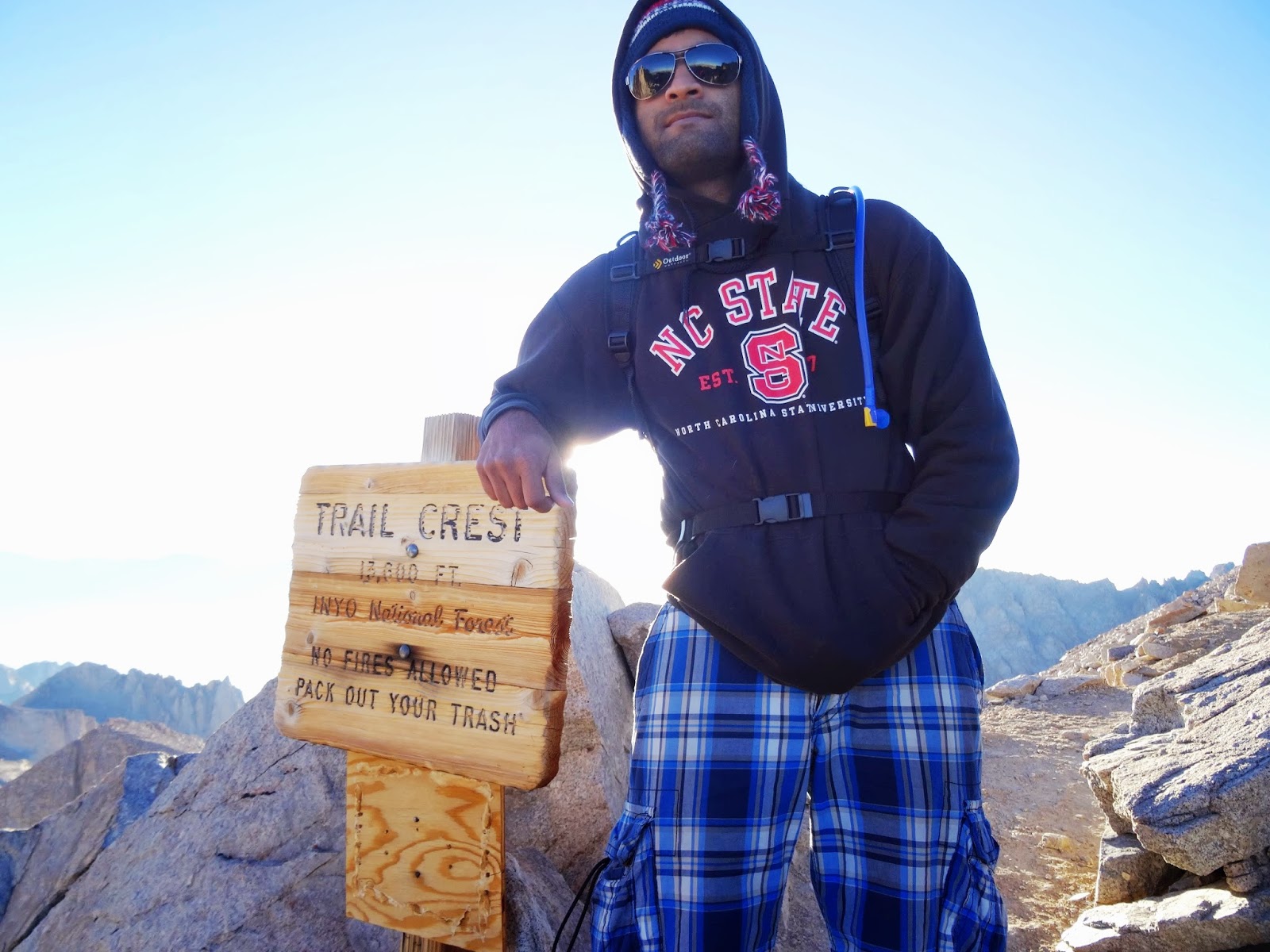
I was woken up at 3:30am and Keerthi was excited to get going to the summit. We were supposed to leave by 4am but getting getting everyone up and ready to leave took longer. It was so cold that no one wanted to step out of the tent. Sathya was a little sick throughout the night and decided not to attempt the climb to the summit. Keerthi and I debated a little about what we had to do and decided that he would be fine by himself till we get back. We started our summit attempt at 4:25am with the help of headlamps and torchlights. The summit was 4.7 miles from Trail camp. The 2.2mile climb to Trail crest (13600’) involved 99 switchbacks and a lot of walking.
This was a painful climb. Three-fourths of the way to Trail crest, I felt my stomach rumble in a strange way. I also started feeling my head ache a little. Altitude got to me. I was contemplating of turning back to Trail camp when I met a fellow mountaineer Kan from Belgium. He had hiked Whitney before and was heading to the summit. I briefly spoke to him and discussed my condition with him. He advised me to take it slow and see if the symptoms increased. It was pretty mild and luckily did not increase. I started following closely behind him at his pace. I felt better or atleast not worse. Kan told me about the sheer beauty that was visible from Trail crest after which I was determined to go up to Trail Crest and then take a decision as to whether to turn back or go ahead.
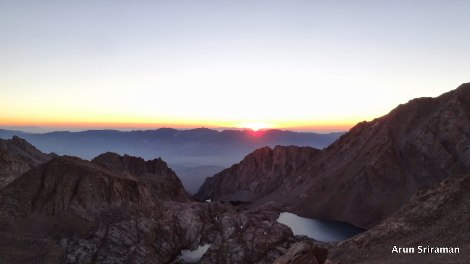
I followed Kan and reached Trail Crest at 6:42am. Oh yes, before that the sun was out by 5:35am, which provided me with some very beautiful memories. It was as if Mother Nature knew exactly what would make me happy at that moment. Soon Shyam, Keerthi and Sreenidhi reached Trail Crest. After a short break, Kan started the 0.5mile hike to John Muir Trail junction and 1.9miles from there to the summit. Being at John Muir Jn. and on John Muir Trail itself was a very special thing to me. It was as if the great man was with me from this point on. I also remembered this quote from him -
"How glorious a greeting the sun gives the mountains!" - John Muir.
I wanted to keep in pace with Kan. We had some good conversations on the way and I felt that I could actually make it to the summit. The trail went down from Trail Crest to John Muir junction and then climbed again. From here on, it was stones all the way. We were literally stone hopping. The pace fell drastically to less than 1 mile per hour. Mt. Whitney wasn’t anywhere in visibility and I was walking right behind Kan. Shyam and Keerthi followed right behind me.
At about 20 mins to the summit, close to 14000’ I felt my stomach spin. It was becoming difficult to walk. I was not tired at all. I felt all the energy I had in me but every step I took, I felt like I was about to puke. So I decided to slow down even further. I bid farewell to Kan and told him I’d meet him up at the summit. Shyam and Keerthi also went ahead behind Kan. Now, it was mind over body for me. I was on the Mt. Whitney Mountain but the summit wasn’t anywhere in view. It was now 10mins to the summit according to fellow mountaineers and hikes heading back. I did not want to move ahead and decided to take a long break. I sat at the same place for 10mins taking deep breaths. It was the longest 10mins of the hike but I was starting to feel better. After thinking a lot about turning back, I decided to go ahead and summit Mt. Whitney. Firm on the decision I started taking one step after another very slowly just looking down at the trail. In 5 mins, the ski hut was visible and I saw Shyam and Keerthi standing and resting. The altitude clearly didn’t affect them. I reached the summit at 8:30am, 10 minutes after Keerthi and 5mins after Shyam.


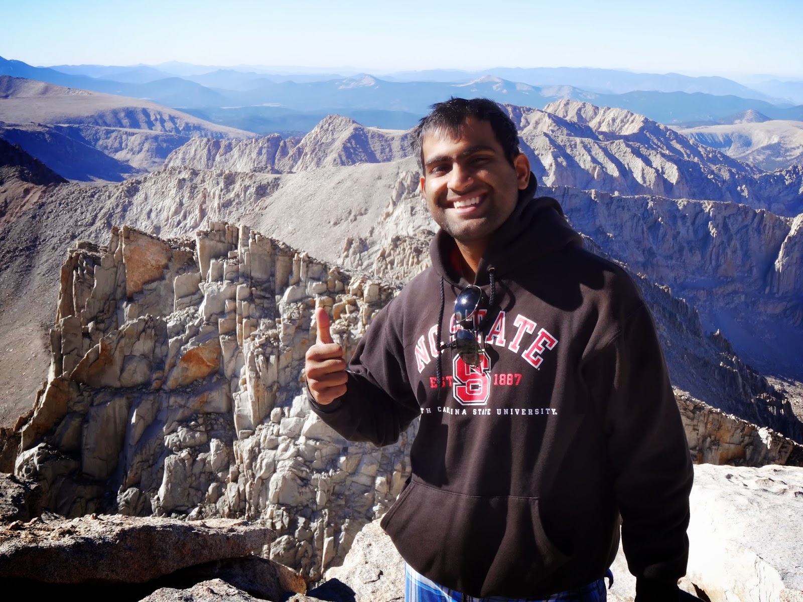
It was a great feeling to be at the Summit of Mt. Whitney at 14505’. We went to the edge of the summit, clicked a lot of photographs, I ate a chocolate and we sat for a while. I then entered my name in the summit sheet that was present in the aluminum box next to the ski hut. We decided to start descent at 9am and also thought that the others would be late to the summit. A fellow hiker informed us that Srineedhi was sick and we shouldn’t have left him by himself on the way. I was a little worried and decided to get going as soon as possible. I too wanted to get down quickly to get rid of the uneasy feeling I had. After 40mins, just when we were leaving, we saw Sreenidhi inching up to the summit along with Srikanth and Anisha. It was great to see them up at the summit. We quickly clicked a group picture and decided to head down in 2 groups. Atleast we could reach campsite and pack things up. Sathya was also alone at the camp. I thanked Kan for his company and we started our return journey to base camp (Trail Camp) at 9:10am. By 10:00am we were near the John Muir junction and by 11am we were in full speed moving down to the camp on the switchbacks. The switchbacks seemed never ending and just kept going. I felt much better at Trail Crest (13600’) and was now very happy to be walking down. After what seemed a very long walk we reached Trail Camp close to 12:00pm ( I don’t recall the time). < Journey Down >We packed the tents and cleaned the campsite. At 1:15pm we were ready to leave but waited for the 2nd group to come down. They reached the camp site close to 1:20pm. We talked for a while and finally decided to split the group into two - the first group – Me, Sathya, Shyam and Sreenidhi and the 2nd – Keerthi, Anisha and Srikanth. We decided to move to trail head as soon as possible and push off to the bay area. The first group deported Trail Camp at 1:45pm I guess. The journey down was fast paced and long. I’m going to skip the details here. We reached outpost somewhere around 3:00pm I guess. Had a granola bar for lunch and continued towards Whitney Portal. We were down by 5:25pm. Weighing the bags again – my backpack was at 35pounds (great right) :-D. We freshened up, dumped the garbage and went to the Portal store to see if we could get something to eat. I bought myself a t-shirt. I had wi-fi there so sent a message to Sanju (my cousin) about my safe summit and descent and we were lolling around at the Portal. By the time we were about to leave, Keerthi and the others (Anisha and Srikanth - 2nd group) made it down. It was 6:30pm. I reached home at 2:30am in the morning, took a good hot shower and went to bed.

This was an amazing experience to me that allowed me to understand my body better at high altitudes. If it were not for Kan and Keerthi, I would have probably not made it to the summit. I owe them big thanks. I am now excited to climb Mt. Rainier and come back to Mt. Whitney during the winter days for more technical climbs. Although I was affected a little by high altitude, I am now in love of the heights. Higher mountains here I come. Some info: *Day 2
More info: Timberline trails
Google Sites
Report abuse