Mitchell Canyon Eagle Peak loop hike
Date: 29th July 2012
No. of days: 1 day hike
Difficulty: Medium / Hard
Picasa Web Album Link: here
A quick ad-hoc plan to go on a trek/hike was put forth by Mr. Abhinava and we (Abhinava and I) decided to go ahead. I rented a car from the San Jose airport on Saturday late in the night (yeah late cause I had gone to Sacramento the same day for sky diving. I got the car and returned home (sunnyvale) at 12:30am on the 29th. We decided to leave towards Mount Diablo at 9am which was a mistake. Lesson learnt over and over again - Treks/Hike should start very early in the morning. I reached Abhi's place in Milpitas at 9:30am and we started the 1 hr journey to Mt. Diablo. The GPS was taking us to the right place but since I had been to Mt. Diablo on Saturday I was confused when the exit approached but the GPS did not ask us to take it. I took the exit and then later realized that although the exit leads to Mt. Diablo, its not where we had to go. We had to go to Mitchell Canyon road which is on the other side to be approached from the west. So after double backing, we reached the base - start point at 11:50am (Mitchell Canyon Visitor Center).
After a brief route discussion with the park ranger there, we collected the trail maps and started our hike. This was right at 12:00pm midday.

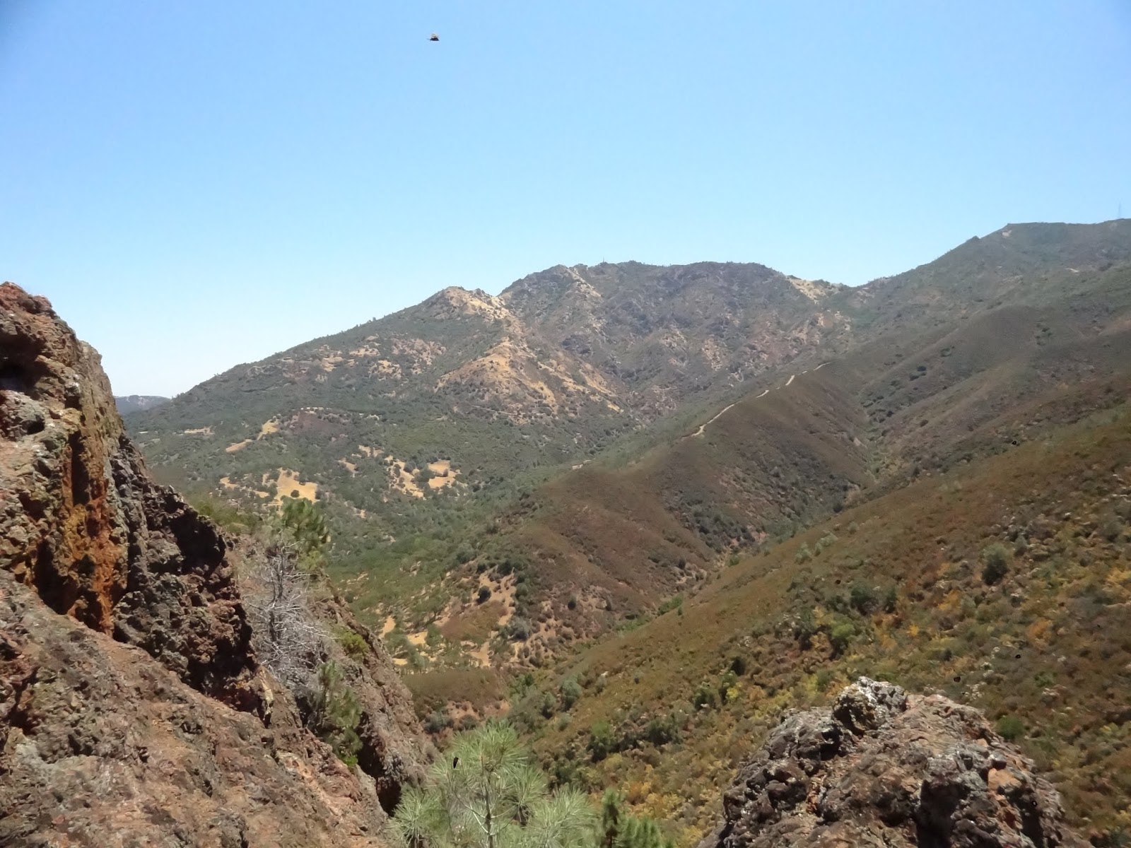
The sun was shining brightly overhead and the temperature was a whopping 38 degrees Celsius (a 100 F). We took the Mitchell Rock trail to Twin Peaks. It was not a very tough route but the temperature made it even harder to climb. We took a couple of breaks on the way. But to my surprise, our first break was atop twin peaks. That made me feel we were in good shape and had made up good time. We had about 2 gallons of water and a lot of stuff to eat, thanks to Abhinava's parents who are here visiting him. I felt it was a sure shot hike to the peak. The hike from Twin peak to Eagle Peak along the Eagle Peak trail was excruciatingly painful. There was literally no shade whatsoever. It reminded me of the Bandajje Arbi trek's Grassland part of the ascent. After a while we reached Eagle Peak. It was about 1:20pm. We were making very good time. Eagle Peak by the way is at 2369 feet (my watch however was off by a huge 300 feet - no wonder the label says not to use it for skydiving or flying :-D).
We had some chocolate, water and decided to chug along the trail. We took a left at a Y intersection and ended up loosing altitude. It was somewhat fishy and Abhinava was pretty much sure that we had taken the wrong path. Having trekked in various locations I've been used to trails descending a lot before a steep ascent but then I remembered what the park ranger said - "Keep going up.. If you are going down you are heading the wrong way". So finally after a mile we decided to turn back. We came back to the Y bend and continued on towards Murchio Gap. It was 2:20pm and we decided to find a tree and break for lunch. Looking at the steep descent and the rugged path, I decided to head back to the base. We were about 4 miles to the summit and it was already 2:20pm. (Remember I told you earlier, treks/hikes should be started
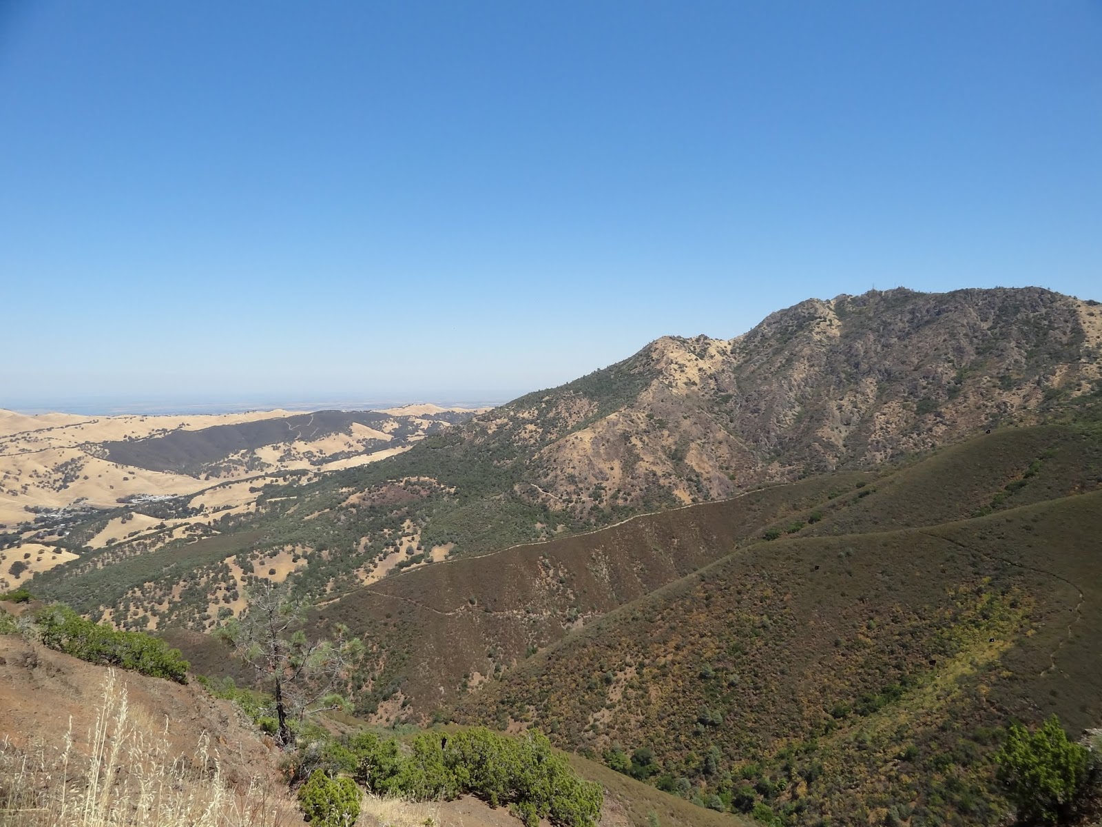
early - this is the reason why..).. Anyways, we had some great tasting toasts with butter and jam. Relaxed a bit enjoying the scenic surroundings. At 3pm, we started heading back the way we came. At 3:25pm, we reached the Eagle peak again. There was a fellow trekker there who after inspecting his map, told us that we could easily make it to the top by 5pm at a good pace. I've never changed my decision of turning back before but this time, I thought we could give it a shot. May be hike another hr or so and then take a decision as to whether go ahead or turn back. We reached Murchio Gap at 4:20pm. It was a gamble now to either go ahead by using the bald ridge trail to prospectors gap and then north ridge trail to mt. Diablo peak. But this was a huge gamble and we didn't want to risk it. We had to get back down by 8pm since I had to return the car by 11pm at San Jose airport. After hard thoughts, we decided to get down to the ranger station. We had anyways reached Eagle Peak which is what the loop actally is. We hadn't followed any loop/trails. We took the back creek trail to Back Creek Rd, from there went onto Bruce Lee Road and then took the Coulter Pine Trail back to the ranger station at Mitchell Rock Staging center. That was the eventful trek of about 12miles after a long time.
After that we did visit the Livermore temple on our way back to San Jose/Milpitas!
